"It should fit according to the drawings" can become an expensive assumption during an industrial retrofit. Existing drawings may miss modifications, access restrictions or details that matter during installation.
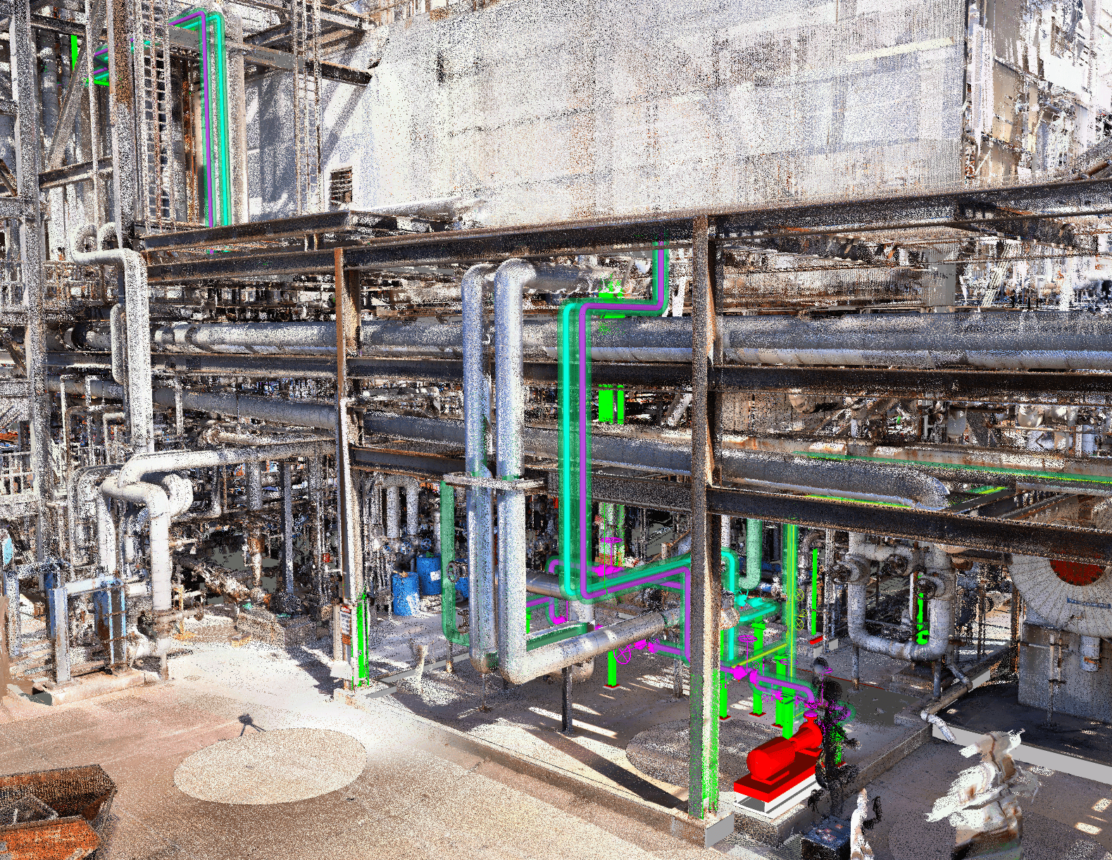
This point cloud shows a proposed retrofit design overlaid on the existing facility. Bringing the two together lets the engineering team examine how new piping and equipment will fit around what is already there, while changes are still practical.
Connecting the scan to detailed engineering
The scan provides measured spatial information. Detailed engineering turns that information into a coordinated design: equipment locations, piping routes, connections and the drawings needed to communicate the proposed work.
Working in the same spatial reference helps the team check more than individual dimensions. A pipe route may clear an existing beam but obstruct a valve, maintenance space or access platform. Reviewing those relationships together helps identify conflicts while the layout can still be adjusted.
Planning how the work will be installed
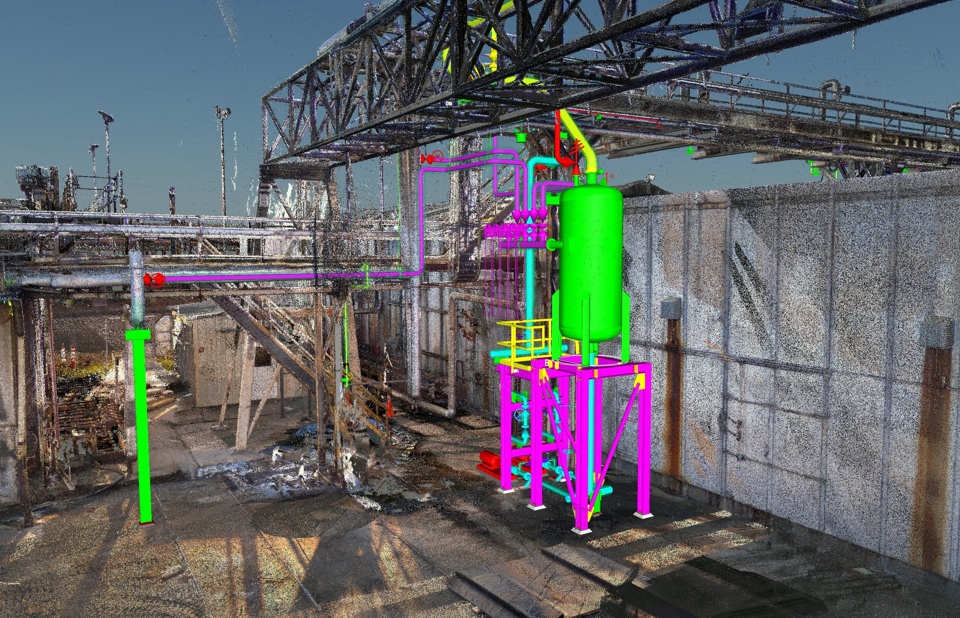
A design also has to reach its final position. The point cloud can support discussions about equipment access, installation routes and the order in which modifications will be made. Operations and construction teams can review the proposed arrangement together and identify areas that need a closer field check.
Compared with relying on isolated measurements, the scan gives those discussions a broader view of the surrounding facility. It can also help answer later dimensional questions without a separate trip for every measurement, provided the relevant area was captured at suitable accuracy.
Keeping field verification in the plan
A point cloud does not reveal everything about an existing plant. Obstructed areas, concealed connections and changes made after scanning still need attention. The survey scope, capture date and known gaps should stay with the model so the team understands where additional verification is required.
The benefit is a retrofit plan that accounts for the facility around it. Connecting the scan to engineering and installation planning gives the owner and contractor a clearer basis for resolving interfaces before they become fabrication changes or field rework.
CPE uses reality capture to bring existing conditions into the design process and help project teams plan modifications with greater confidence.